
Summary
General Information
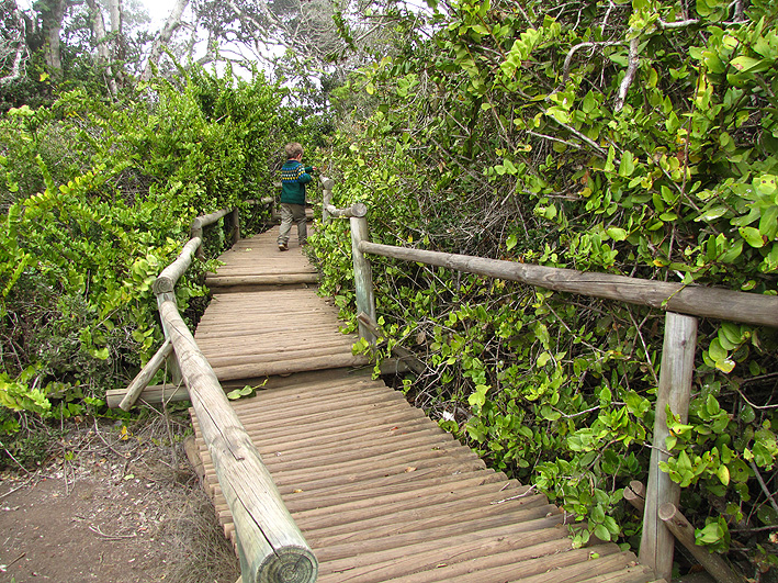
Bosque Hidrófilo
Country: Chile
Region: Región de Coquimbo
Area: Parque Nacional Fray Jorge
Nearest city: Ovalle
Number of journeys: 1
Total distance: 938
Trail Markings: Frecuente y clara
Trail: Claro y marcado
Route type: Circuito
Fauna
Bosques
Flora
Panorámicas / Paisaje
Apto para niños menores de 10 años
Graduations (4)
I did it
Hiking routes
BOSQUE HIDRÓFILO
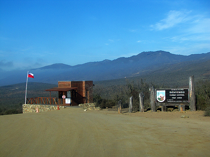
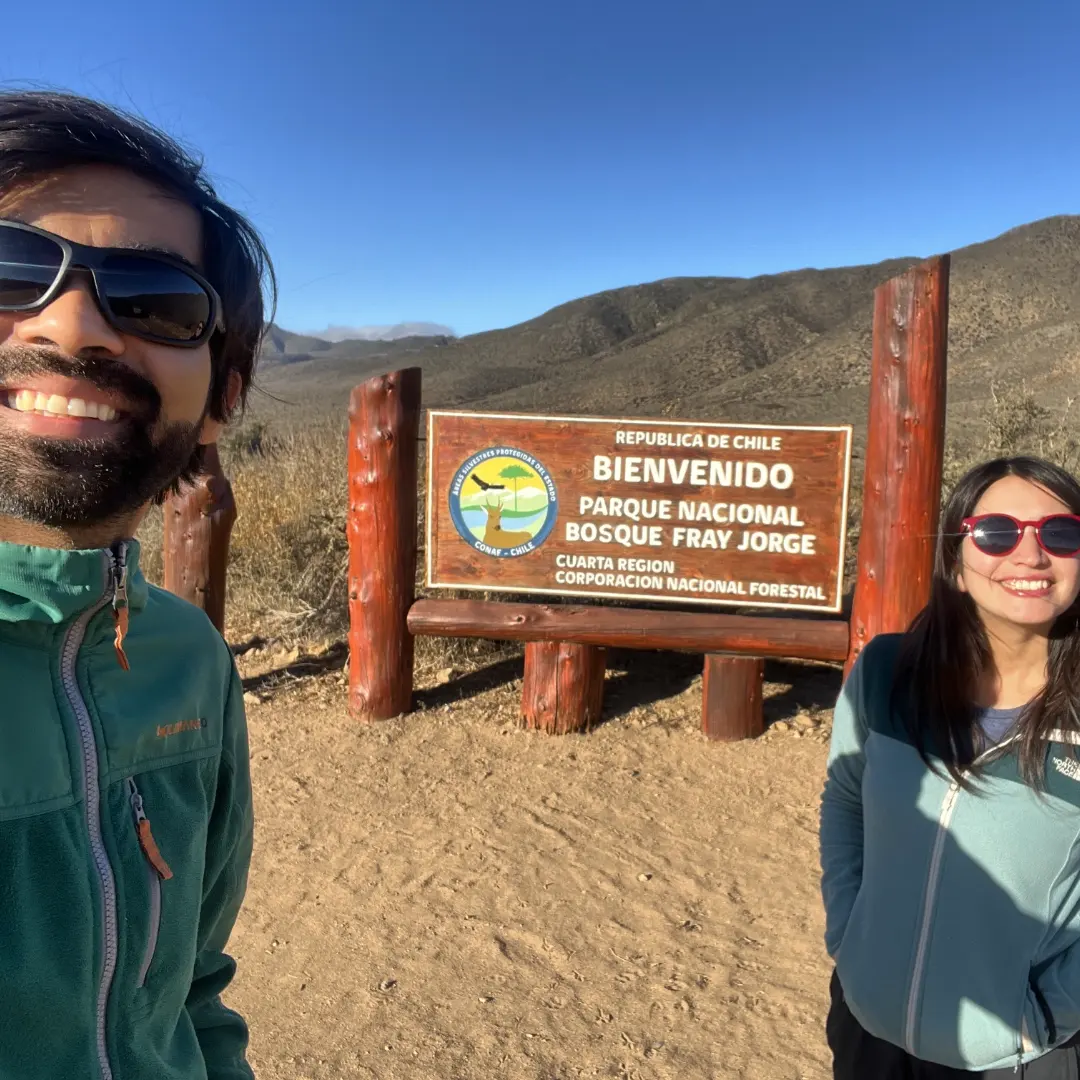
Parque Nacional Fray Jorge
Author: Álvaro Vivanco
Introduction
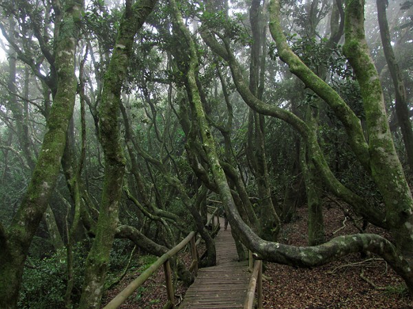
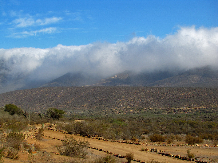
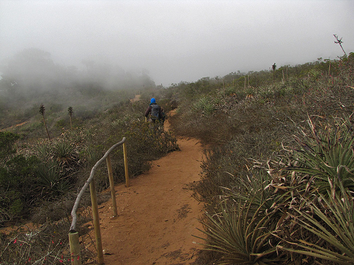
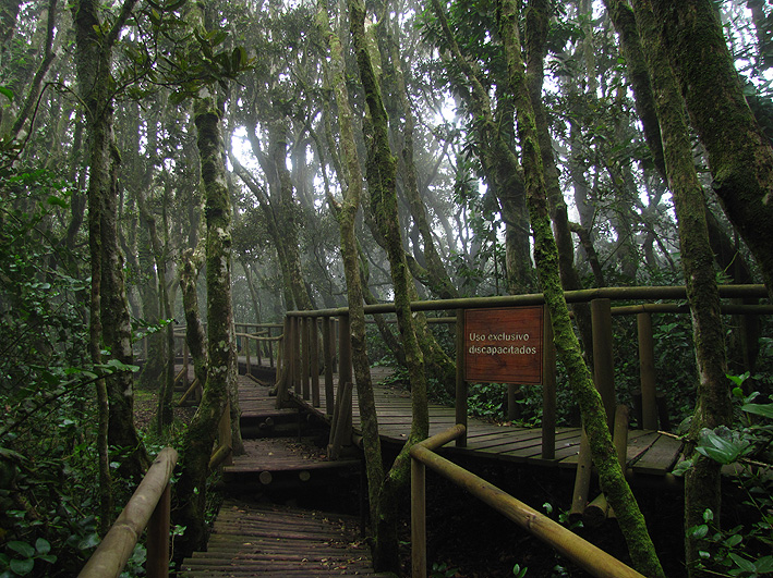
Within Chile, the Parque Nacional Fray Jorge is geographically unique – so much so that it was the first Chilean National Park to be declared as a Biosphere Reserve in 1977. The reason for this is its great hydrophilic forest, also known as Valdivian forest, which has managed to survive in the middle of a semi-arid zone, completely isolated from similar forests. Thanks to its proximity to the sea and the height of the hills on which it sits, a large quantity of thick fog accumulates over the park and this creates the necessary humidity that this forest needs to thrive.
Among the park’s atypical vegetation, there are various species of tree normally found in the south of Chile such as the olivillo (aextoxicon punctatum); the canelo (drimys winteri), a tree considered to be sacred by the Mapuche people; and the national flower of Chile, the copihue (lapageria rosea).
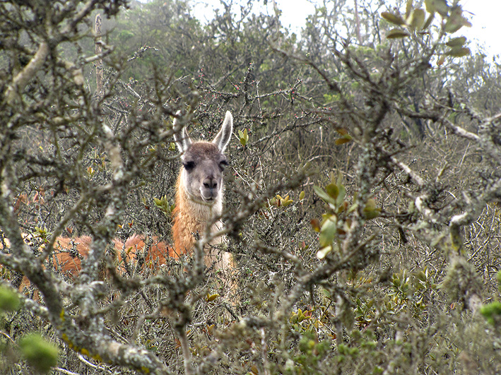
To make the visitors’ time in the park even more interesting, with a little luck you may be able to see guanacos (Lama guanicoe), a species previously extinct in this region which had been successfully reintroduced by Conaf. It is also common to see other mammals such as the Andean fox (Lycalopex culpaeus) and rodents like the degu (Octodon degus).
Appropriate season
All year around.
Access
To reach the Parque Nacional Fray Jorge, you will need to reach kilometre 387 of the Carretera Panamericana Norte (Northern Pan-American Highway). This point is 110km to the south of La Serena and 387km to the north of Santiago. The closest town is Ovalle. To reach kilometre 387 of the highway from this town you should follow the road which in 37km connects Ovalle with the Termas de Socos and from here take the Northern Pan-American Highway to the north for another 19km.
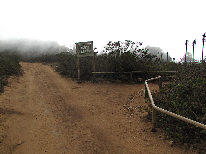
From the turning at km 387 on the Northern Pan-American Highway, it is 27km to the park entrance via a dirt road. From the park entrance, where you have to register your entry, continue for another 3km until reaching the Conaf information centre. From here the road continues west and begins to climb a steep slope for 5km. If your car isn’t powerful enough to go up the slope, you can leave it at the start of the ascent and walk for 3km to the start of the route. If on the other hand your car can climb the slope, after 5km you will reach the car park alongside the forest, the start of the route for those with reduced mobility and the Bosque Hidrófilo route. Be aware that the road is not well maintained therefore it’s not in great condition, but as there isn’t much rain in the zone it stays relatively unchanged.
The park cannot be reached via public transport. However, in La Serena various tourism agencies offer the opportunity to visit the park for the day.
Permits / Prices
The entry fees to the park are as follows: adults CLP$2500 (approx. US$5), children CLP$1000 (approx. US$2).
Low season (April – November): Thursday to Sunday and holidays you can enter the park from 9:00 to 16:30. The park closes at 17:30. Closed Monday, Tuesday and Wednesday.
Peak season (December – March): you can enter the park from 9:00 to 16:30. The park closes at 17:30. The park is closed on 25th December and 1st January.
If you wish to check if any changes have been made to opening hours or prices, go to the park's official webpage, where you can also find contact numbers and email addresses of the park’s contacts.
Accommodation / Facilities
There is no camping area in the park. Previously there was the possibility of staying but due to the water shortage and the danger of fires it was prohibited.
The old campsite has now been made into a picnic area.
The closest place to stay or camp is in the Termas de Socos where there is a hotel and a campsite.
Recommendations
- Take enough water with you as you won’t find any along the route.
- If you eat in the picnic area, do not feed the foxes which often come searching for food.
- There are only toilets and bins in the information centre and the picnic area.
Gear
- Trekking boots or trainers
- Sun protection
- Warm clothing (as well as fog, there are can strong winds in the higher areas of the park).
Schedule
- Ovalle - Bosque hidrófilo - Ovalle


Comments
Bosque Hidrófilo
Nicolás Berríos 16/03/2024
Other excursionists: Marjorie Carvajal
Fecha expedición: 08/03/2024
Hermoso sendero en medio del secano costero. Una maravilla para visitar al menos una vez :)
Álvaro Vivanco 03/07/2015
Punto alcanzado: Bosque hidrófilo
Fecha expedición: 27/06/2015
Extraordinario parque nacional y recorrido por el bosque. La neblina le dio un toque increíble al bosque. Vimos guanacos y zorros culpeos. El bosque parecía traído del sur de Chile.
Tracks and Waypoints
Bosque Hidrófilo
Aportado por: Álvaro Vivanco
Fecha: 13/07/2015
Ruta Vehicular desde Panamericana Norte (ruta 5) hasta PN Fray Jorge
Aportado por: Lorena Lagos
Fecha: 12/07/2015
Ruta acercamiento vehicular hecha manualmente por eso no tiene gráfico de nivel de altura
I did it!