Summary
General Information
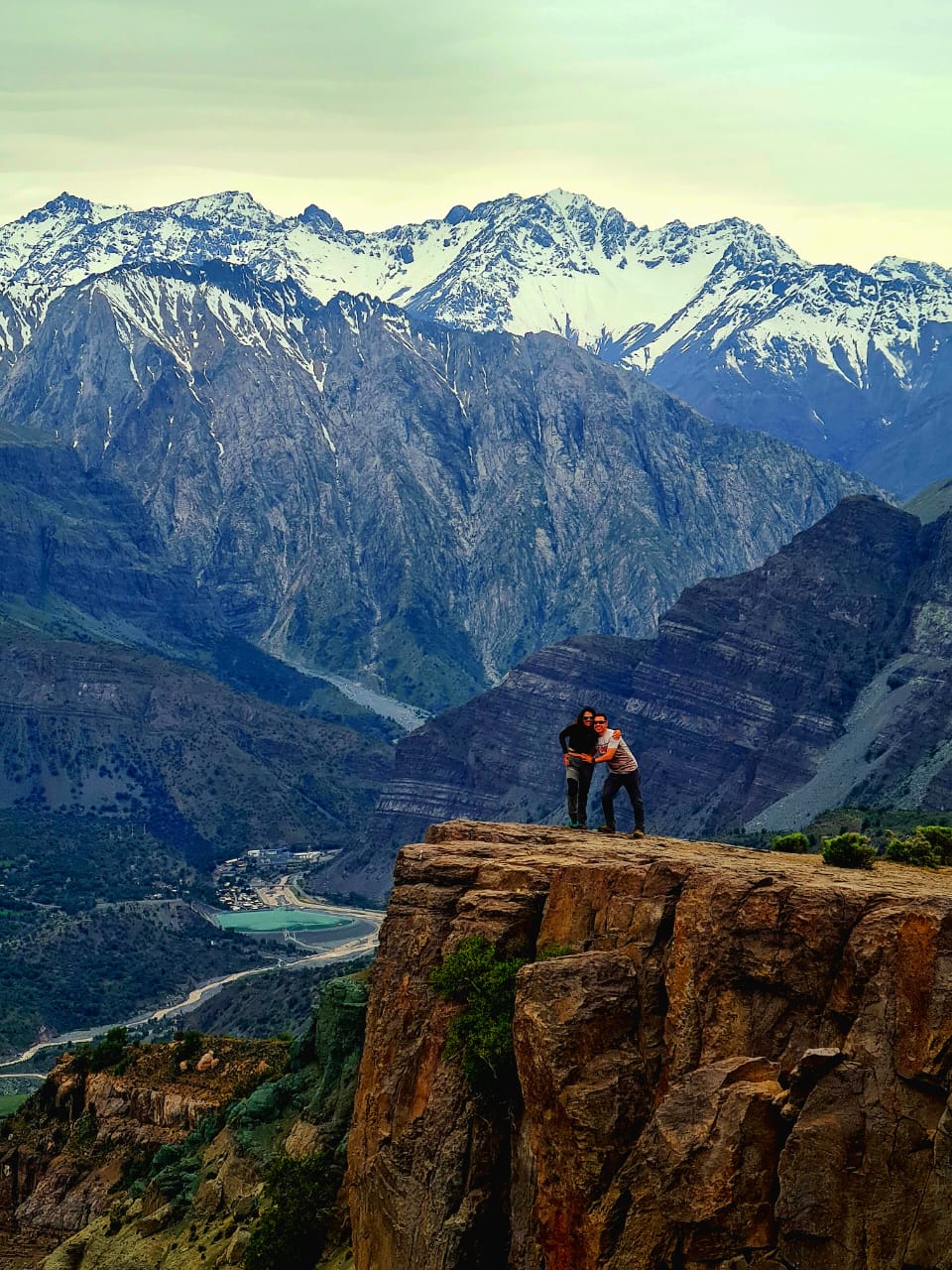
Mirador de los Cóndores
Country: Chile
Region: Región Metropolitana
Area: Alfalfal, Cajón del Maipo
Nearest city: San José de Maipo
Number of journeys: 1
Total distance: 10km
Trail Markings: Inexistente
Trail: Claro y marcado
Route type: Ida y vuelta
Fauna
Panorámicas / Paisaje
Apto para niños menores de 10 años
Difficulty:
I did it

Hiking routes
MIRADOR DE LOS CÓNDORES
Alfalfal, Cajón del Maipo
Author: David Valdés
Introduction
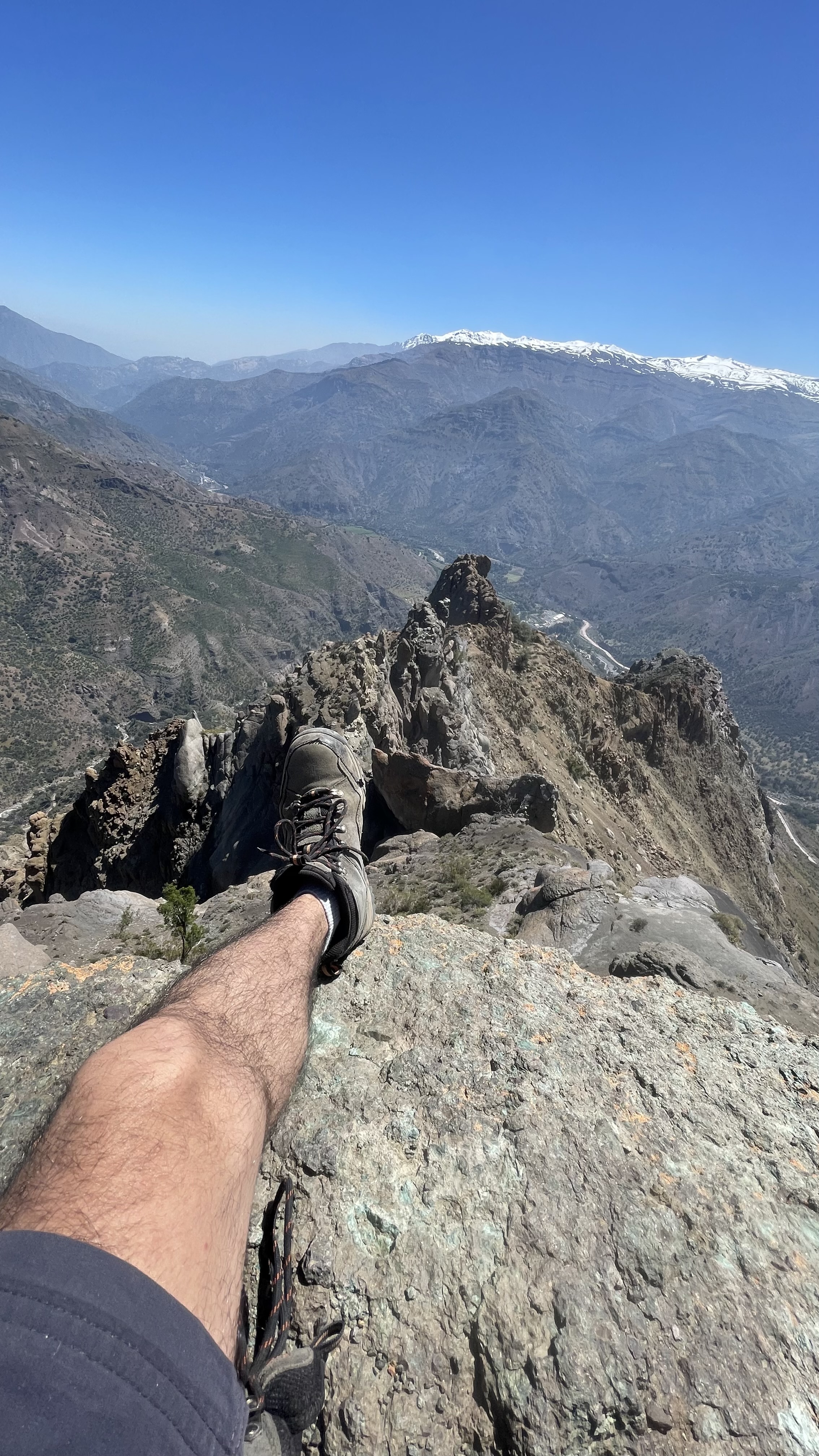
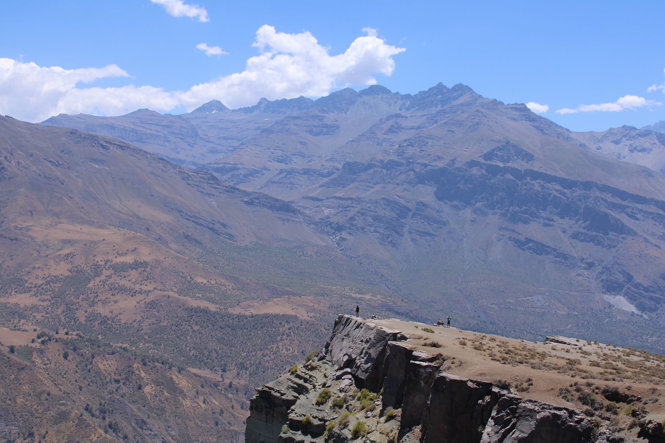
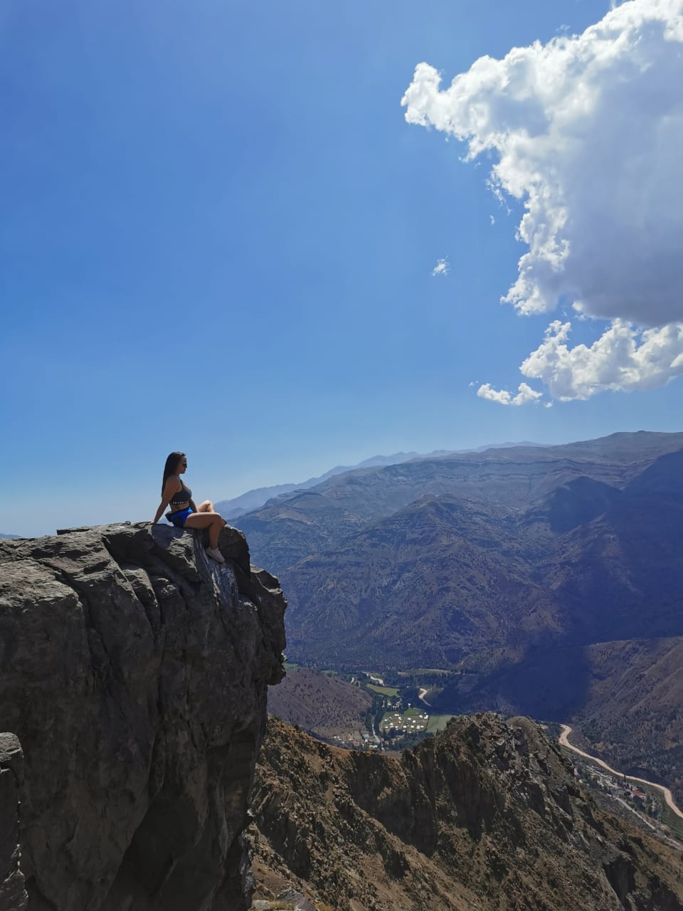
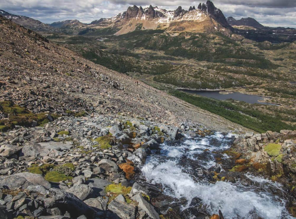
Located in Alfalfal in Cajón del Maipo, Mirador de los Cóndores is an scenic trekking trail that leads to an elevated area on top of some rocky outcrops. These impressive formations offer a striking vantage point over the intersection between the Aucayes Gorge and the Colorado Gorge. In this remote and protected area far from human activity, Andean condors (Vultur gryphus) and black-chested buzzard-eagles (Geranoaetus melanoleucus) build their nests, and so it is quite common to see these large birds flying overhead.
The trail, which can be completed in a single day and is suitable for the whole family, leads through areas of native plants and trees, such as peumo or Chilean acorn, litre, espino, maitén and various species of indigenous cacti.
This trail is an excellent option for a daytrip from Santiago.
Appropriate season
All year round. To avoid the heat, it is recommended to visit outside of the summer months. Additionally, during winter the surrounding mountains are snow-capped and a small lagoon appears in the middle of route, which only accentuates the trail’s beauty during this period.
Access
From Santiago, follow Route G-25 towards Cajón del Maipo. Approximately 12km after passing through the sector Las Vizcachas, cross the bridge over the Colorado River. Once on the other side, turn left (northeast, Route G-345) towards the small villages of Maitenes and Alfalfal, located on the southeastern bank of the river.
From the turn-off, continue for approx. 19km along a paved road until you reach the Trescientos gully, essentially a dry river bed for most of the year (not signposted from the road). You can park in the open area on the western side (left side of the road), just past the gully.
There is no public transport from Santiago to the start of the trail.
Permits / Prices
There are no permits or entry fees required.
Accommodation / Facilities
There is no accommodation, shops or toilets.
Recommendations
- Take care when approaching the edge of the rocky cliff top as there is loose rock. A fall could prove fatal.
- During the second half of the route, the trail crosses the Cincomil stream. However, it is advisable to take enough water with you from the start, given that the stream passes through a grazing area for animals.
- Keep the trail clean, do not litter and take any trash home to dispose of properly.
Gear
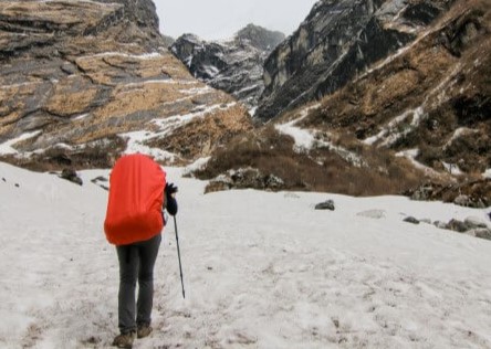
- Clothing suitable for the time of year and weather conditions
- Trekking boots
- Plenty of water (approx. 2 litres per person)
- Trekking poles (optional)
Schedule
- Santiago - Mirador de los Cóndores - Santiago


Comments
Mirador de los Cóndores
Christian Lopez 07/03/2022
Punto alcanzado: Fin de ruta
Fecha expedición: 30/01/2022
Excelente camino. Fue un poco duro en el inicio, pero se logró llegar al final.
Erwin van Vroenhoven 05/01/2022
Punto alcanzado: 2000
Fecha expedición: 04/01/2022
Good parking, route easy to find. Big climb - 700m in 5 km. Spectacular view. Unfortunately no condors
Luis Aravena cancino 27/10/2021
Fecha expedición: 25/10/2021
Excelente vista nos perdimos al ir no se si por la falta de señaleticas o por que no sabíamos el camino pero igual se logro
Esteban Flores Straube 18/07/2021
Punto alcanzado: CUMBRE
Fecha expedición: 18/07/2021
Camino marcado por senderos visibles. 1 hora 540 min de ascensión.

I did it!